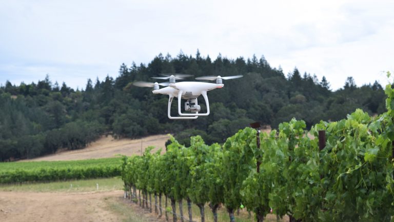
From searching out leaf roll to assessing vine vigor, many vineyard managers turn to the skies for intelligence gathering. Some still rely on satellite imaging or documentation gathered from airplane surveillance, but a growing number are opting for something smaller, nimbler, and more efficient to fly: drones.
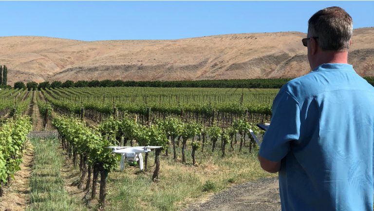
Because a drone has the ability to fly much closer to the canopy, it provides a more detailed look at individual vineyard areas. Where satellites might provide 2-meter resolution, drones can provide 2.5-centimeter resolution. Grape growers can use drones to assess a vineyard more frequently. Observing a vineyard aerially 5 or 10 times a season, rather than making an assessment based on a single fixed-wing flyover, enables vintners to assess the progression of leaf roll, for instance, or see how irrigation choices are affecting vigor in a particular block.
In general, drones offer vintners a greater level of flexibility than fixed-wing aircrafts, says Keith McCall, the founder and CTO of Pollen Systems, an ag-tech company in Bellevue, Washington, which offers both fixed-wing and drone flyover services to its customers. Drones, he points out, can be scheduled to fly at specific times of day without concern for image defects or shadows from third-party flyovers; they can also easily be rescheduled if a storm rolls in. Drones are more reliable than planes if smoke from forest fires is present—flights may need to be canceled, but a drone will not be affected by smoke.

Don’t miss the latest drinks industry news and insights. Sign up for our award-winning newsletters and get insider intel, resources, and trends delivered to your inbox every week.
Drones are also better at helping vintners troubleshoot specific issues, such as where to fertilize, apply pesticides, prune, or perform differential harvesting, says McCall. “This saves money in pesticides, fertilizer, and labor costs,” he says. He adds that fixed-wing aircrafts “can cover more terrain faster, [but it’s] with the tradeoff of poorer resolution and more defects caused by shadowing and picture angle.” Pollen charges $1 to $4 per acre for a 5-minute fixed-wing flyover of 100 acres and $5 to $10 per acre for a 60-minute drone flyover of the same sized area.
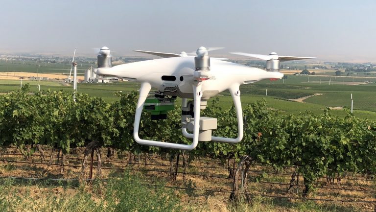
Drone technology is still evolving, and one major area of research is dedicated to using drones for the detection of plant diseases. But many drone tech companies and viticulturalists are putting these aerial robots to work in vineyards for other purposes as well.
Assessing Loss from Above
Terra Spase, based in St. Helena, California, was one of the first companies, in the early 1990s, to provide tech and data consulting services to U.S. vineyards. Led by its founder, Paul Skinner, who has a Ph.D. in soil science and viticulture, the company managed weather network stations for individual clients. Because the entire region’s data was gathered by its office, for example, Terra Spase was able to predict the risk of disease—like mildew—across all of Napa Valley.
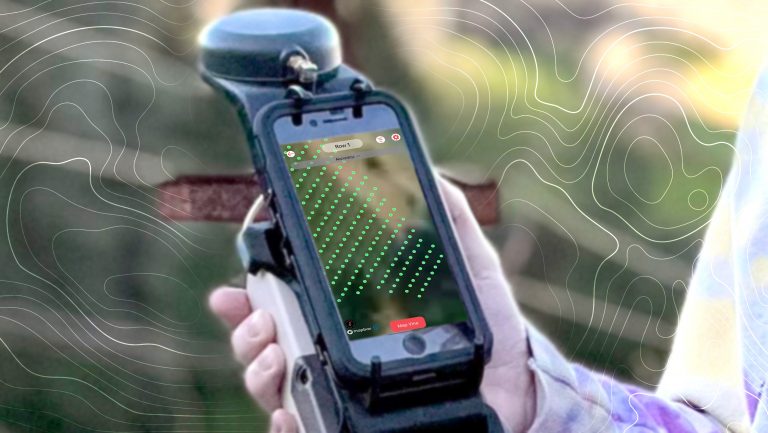
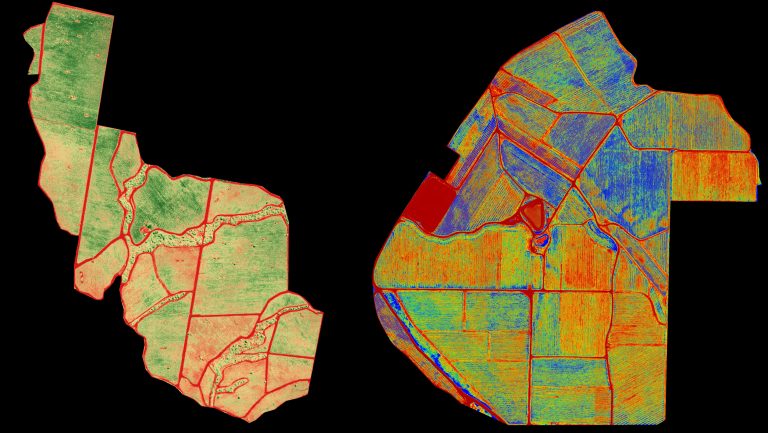
Today, Terra Spase’s work with tech in the vineyard continues in additional ways. After the 2017 wildfires in Northern California, the company was hired to do an insurance assessment of a vineyard that abutted the fires. Examining the vineyard row by row would have been tedious. “You could have spent weeks out there tallying the vines,” says Skinner. So he hired a drone flyer to map the vineyard instead. Using normal color imagery as well as normalized difference vegetation index (NDVI) data, Terra Spase learned that the fire had killed vines erratically. “Some vines were burned to charcoal,” Skinner says. “Other vines were just heat scorched, and other vines weren’t affected at all.”
Using Drones to Map Vigor
Michael Mastrofini, the cofounder of Drone Oregon, a drone services company based in Ashland, calls the multispectral imaging that drones can supply one of the most useful tools in the state’s Rogue Valley because these cameras can capture reflectance off plants. “A high reflectance value shows a lot of water content within the plant tissue—[the plant] reflects the light not used for photosynthesis back into the air,” says Mastrofini. “A plant that might be diseased, stressed out, or not getting enough water or nutrients is going to start showing signs of chlorosis and won’t have a very high reflectance value.” With drones, the company is able to map those areas in a vineyard and address any problems. It can also use drones as a scouting tool for canopy management, identifying from above rows that need more thinning, for example. “One of the biggest benefits for management,” Mastrofini says, “is to have that tool to be able to pinpoint everything and reduce the variability throughout vineyards.”
Randy Ullom, the winemaster for Kendall-Jackson, based in Sonoma County, California, has been using drones to gather NDVI data for about four years to map relative plant vigor within Kendall-Jackson’s vineyards. “The demand for the kind of information these drones can provide,” he says, “far exceeds our capability to provide it.” It’s not just that there’s high demand for the information drones can provide, says Ullom, but that the amount of data needed and the time it takes to process that data, and then use it for determining, for example, yield estimations, exceeds Kendall-Jackson’s current capacity.
By measuring vegetative growth, drones can identify weak spots in a vineyard or areas with excessive vigor, for example. “It’s quick and easy to be able to see changes happening in the vineyard from a map taken from the air,” says Ullom, who notes that this vegetative growth can influence the management of the vineyard. “From pictures, you kind of figure out what growth is related to soil moisture,” he adds. “It affects how we’ll sample and taste vineyards and blocks before harvest. If there’s a huge weak area, we may harvest it last—or at a different time.”
This drone-collected data can also work to map vineyard pests, as Pollen Systems often does with the coyotes that frequent Washington State’s vineyards. When summer temperatures soar to 110 degrees Fahrenheit, coyotes will seek water in vineyards. When they recognize the cold flow of water through an irrigation line, they’ll chew it, leaving holes. Drip irrigation becomes a bit more effluent then.

It takes Pollen Systems 20 to 25 minutes’ worth of drone time above one 25-acre Red Mountain AVA vineyard to capture roughly 400 pictures. Those photos are uploaded to the company’s portal and then, over a period of four to eight hours, stitched together to form a complete picture of the vineyard. Vineyard clients can then view a progression of images, and the company will help them understand or parse the resulting information.
Areas of vigorous growth—not only in the vines but in between and surrounding the rows—show up as brilliant blue dots on Pollen’s maps. That intel can show vineyard managers where they need to do line repair.
A Future for Disease Detection
The biggest hope for drone tech, however, may lie in disease detection. Pollen Systems has had success with detecting such diseases as leaf roll, which typically can’t be identified by a fixed-wing aircraft. “Because we’re flying drones so low,” says McCall, “and we’re getting to an image accuracy of one centimeter per pixel, we can see the leaves and detect the patterns on the leaves. We can see if the leaf roll virus is in a specific section of the vineyard—and can see where it’s spreading to.”
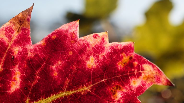
What drones can’t do is distinguish leaf roll from red blotch, at least yet. The two appear similar from above—in both, the leaves turn red in early fall, largely at the base of the shoots, but in red blotch–infected plants, there is no rolling and the veins of affected vines show pink or red on the leaf undersides. Pollen has begun testing ground-based robot autonomous scouting vehicles, designed in conjunction with the University of Washington, which capture images of crops from the ground and augment drone surveys. Not only can this help estimate crop yield prior to the harvest season, but it might also someday help identify those telltale signs of red blotch.
Red Blotch Rising
A new virus that started spreading across California vineyards—and the nation—in the 2000s is under investigation
In Europe, companies have begun using drones to detect flavescence dorée, which causes leaves to yellow and grapes to shrivel. Alexander Levin, a viticulturist and an assistant professor in the Department of Horticulture at Oregon State University in Central Point, also hopes that someday drones might be used to identify powdery mildew, which would allow vineyard managers to spray only the hot spots.
“One of the biggest hopes in all of this is that if we can do this,” says Levin, “we can identify vines that have disease before we see symptoms. That’s what everybody wants. Whether it’s a grapevine or a human body—if there’s a disease, you want to catch it before it becomes a problem.”

Dispatch
Sign up for our award-winning newsletter
Don’t miss the latest drinks industry news and insights—delivered to your inbox every week.
When she’s not writing about beverage, travel, or weird science, Julie H. Case can be found deep in America’s forests, foraging for mushrooms.

